What is the information found in reference maps vs thematic maps?
Reference maps - general info/navigation/location of places
Thematic maps - spatial aspects of data/phenomenon
List the different types of reference maps
Political, physical, road, plat map
List the different types of thematic maps
Choropleth, dot-density/distribution, graduated/proprotional symbol, isoline/topographic, cartogram
Regional Scale
Multiple countries (supranational region) or OF a region (subnational)
Local Scale
Anything smaller than a country
Large scale vs Small scale
Large Scale - Large amounts of detail, zoomed in, smaller amount of area
Small Scale - Small amounts of detail, zoomed out, larger amount of an area
Spatial Patterns
Linear, clustered, dispersed
Every projection has distortion but at least one part of _____ must be preserved
SADD - Shape, area, distance, direction
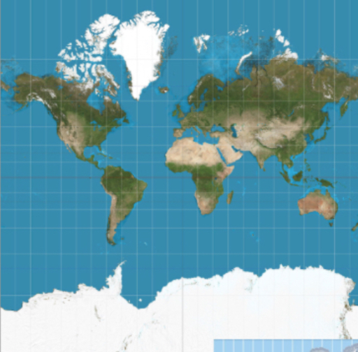
Name the strengths/preservation, weakness/distortion, and fact/purpose of the Mercator Projection
Strengths/Preservation:
Directions are shown accurately
Weakness/Distortion:
Distance between lines of longitude appears constant
Area near poles appear larger
Fact/Purpose:
Used originally for navigation
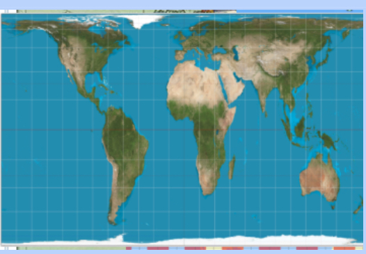
Name the strengths/preservation, weakness/distortion, and fact/purpose of the Peters Projection
Strengths/Preservation:
Area - sizes of landmasses are accurate
Weakness/Distortion:
Shapes are inaccurate, especially near the poles
Fact/Purpose:
Used for spatial distribution related to area
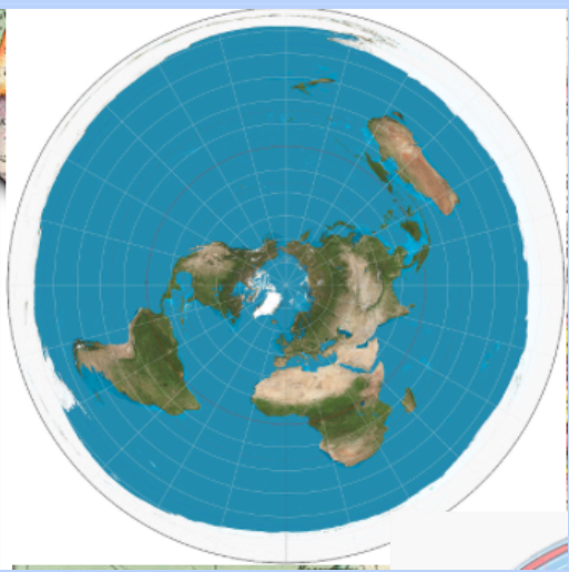
Name the strengths/preservation, weakness/distortion, and fact/purpose of the Polar Projection
Strengths/Preservation:
Distance - Used to show the closeness of all the countries
Weakness/Distortion:
Area - Landmasses closer to poles seem larger than they are
Area - Size of landmasses become more disproportionate the farther one moves away from the equator
Fact/Purpose:
Historically used to depict the face off between the US and the Soviet Union during the Cold War
Name the strengths/preservation, weakness/distortion, and fact/purpose of the Goode-Homolosine Projection
Strengths/Preservation:
Area and Shape preserved
Weakness/Distortion:
Interrupts the oceans
Fact/Purpose:
Spatial Distribution
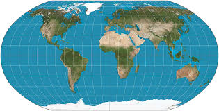
Name the strengths/preservation, weakness/distortion, and fact/purpose of the Robinson Projection
Strengths/Preservation:
No major distortion
Oval shape appears more like a globe than it does a rectangle
Weakness/Distortion:
Area, shape, size, and direction are all slightly distorted
Fact/Purpose:
Used for general purposes - compromise between Mercator and Peters projection
How is data gathered?
Data is gathered through Fieldwork/Field Observations - by individuals or organizations
GPS (global positioning system)
A system of 24 satellites that orbit Earth twice daily and transmit radio signals Earthward; the basis for many map-based apps that provide directions on how to get from one place to another
GIS (geographic information system)
A software application for capturing, storing, checking, and displaying data related to positions on Earth's surface; allows the rapid manipulation of geospatial data for problem-solving and research
Uses of GIS
Analyzing of crime data
Monitoring effects of pollution
Analyzing transportation/travel time
Planning urban areas
Remote Sensing
Cameras or other sensors mounted on aircraft or satellites collect digital images or video of the earth's surface above the atmosphere (aerial photography)
Uses of Remote Sensing
Determining land cover and use
Monitoring environmental changes
Assessing spread of spatial phenomena
Space and Place
Space - An area we occupy as humans, has no value until the people who occupy it make it their own
Place - How we modify spaces based on who we are as a group of people through the process of place making
Cultural Landscape
Built forms that cultural groups create (houses, cities, fields) and the meaning, values, representations, and experiences associated with them; how we leave our mark on the physical environment
Interdependence
Ties between countries/regions eventually creating a global economic system that isn't always equal; creates dependencies
Distance Decay
Inverse relationship between distance and connection; as distance increases, the spread of people and ideas/interactions decreases
Physical barriers + cultural barriers
Time-Space Compression
Increased sense of accessibility and connectivity decrease distance between places by time or cost "the world is shrinking"
Due to increased tech, transportation, internet
Expansion vs Relocation Diffusion
Expansion Diffusion - When cultural traits are spread through exchange WITHOUT migration
Relocation Diffusion - Ppl w ideas/practices migrate to dif location and bring them along
Define the 3 types of Expansion Diffusion
Hierarchical + Reverse Hierarchical, Contagious, Stimulus
Hierarchical + Reverse Hierarchical Diffusion
Ideas leapfrog from 1 important person, community, or city to another, bypassing other areas (ppl/communities) in between
Ideas leapfrog from lower to higher level
Contagious Diffusion
Wavelike spread of ideas WITHOUT regard for hierarchy
Define Sustainability
Using resources now in ways that allow use in the future with minimal negative effects on the environment
Environmental Determinism
Belief that landforms and climate are the most powerful forces shaping human behavior/culture
Stimulus Diffusion
When a specific trait is rejected but the underlying idea is accepted
Formal/Uniform Region
Geographic area inhabited by people who have one or more traits in common (language, religion, livelihood); has borders
What are the traits included in Formal/Uniform Regions
Political (country)
Physical (Sahara)
Economic (EU - bc free trade)
Cultural (Southwestern Nigeria, common language)
Functional/Nodal Region
Organized around a focal point (node) and defined by an activity, often around economic activities, travel, or communication; perform a service
Node
Central point where the functions are directed
Characteristics of Functional/Nodal Regions
Node - Central point where the functions are directed
Many have clearly defined borders
Need flow - could be visible (cars delivering pizza w roads) and invisible (political and legal authority from the capital city)
Functional regions help us function
Vernacular/Perceptual Region
Based on a person's perspective or perception; unique regional name
Characteristics of Vernacular/Perceptual Regions
Fuzzy boundaries (based on different people's beliefs, attitudes/feelings)
Could be named based off physical environment, culture, political, economic historical characteristics, or outsider perceptions/stereotypes
DAM
Societies Depend on, Adapt to, and Modify the physical environment
Data Aggregation
The process of collecting and organizing large amounts of information
Spatial Perspective
A geographic perspective that seeks to identify and explain the uses of space
Spatial Patterns (definition)
Placement of arrangement of objects on Earth's surface; also includes the space between the objects
Scale (definition)
The territorial extent of an idea or object
Absolute Direction
Corresponds to the direction on a compass; north, south, east, west and combinations such as NE and SW
Absolute Distance
Distance that can be measured with a standard unit of length, such as a foot, yard, mile, or kilometer
Relative Distance
Measurement of the level of social, cultural, or economic similarity between places despite their absolute distance from each other
Relative Direction
Direction that can be described as potion, such as in front of or behind, to the left or to the right
Census
Official count or survey of a population, typically recording various details about individuals, such as age, sex, and race (US census occurs every 10 years)
Absolute Location
Precise position on Earth's surface
Prime Meridian
The zero-degree longitude line that runs through Greenwich, England; also known as the Greenwich Meridian
Relative location
Position of one place/person in relation to another
Independent Invention
Occurs when the same or a very similar innovation is developed at the same time in different places by different people working independently
Friction of distance
Inhibiting effect of distance on the intensity and volume of most forms of human interaction; time-space compression diminishes friction of distance
Glocal Perspective
Geographic perspective that acknowledges the two-way relationship between local communities and global patterns, emphasizing that the forces of globalization need to take into account local-scale cultural, economic, and environmental conditions
Contested boundaries
Boundaries that are disputed for religious, political, or cultural reasons
World Systems Theory
Wallerstein's theory of economic development that regards world history as moving through a series of socioeconomic systems, culminating in the the modern world system by about the year 1900 (core, sp, periph)
Dependence theory
The theory that the periphery is poor because it was economically dependent on the core in a disadvantageous relationship originally established under colonialism and imperialism
Commodity dependence
Occurs when commodities account for more than 60 percent of the value of a country's total exports
Mercator Projection
Peters
Polar
Goode-Homolosine
Robinson Projection
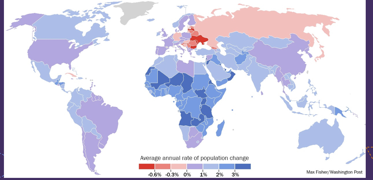
Scale: Global
Scale of Analysis: National
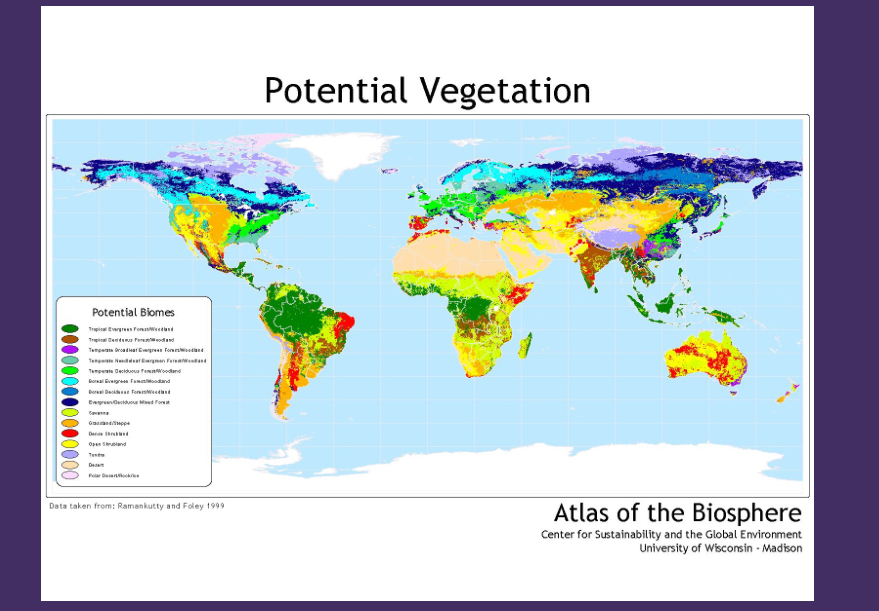
Scale: Global
Scale of Analysis: Global
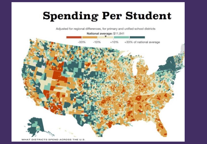
Scale: National
Scale of Analysis: Local
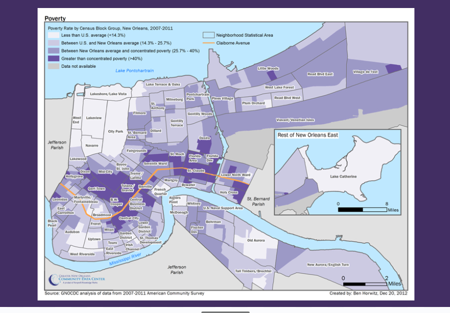
Scale: Local
Scale of Analysis: Local
Environmental Possiblism
Belief that there are a number of possible ways that humans can find ways to overcome environmental challenges