Map Projection
When you display the round earth on a flat surface
All map projections cause…
distortion.
Conformal Projection
Preserves shapes of land, but distort size
Equal-Area Projection
Distorts oceans to preserve shapes of land
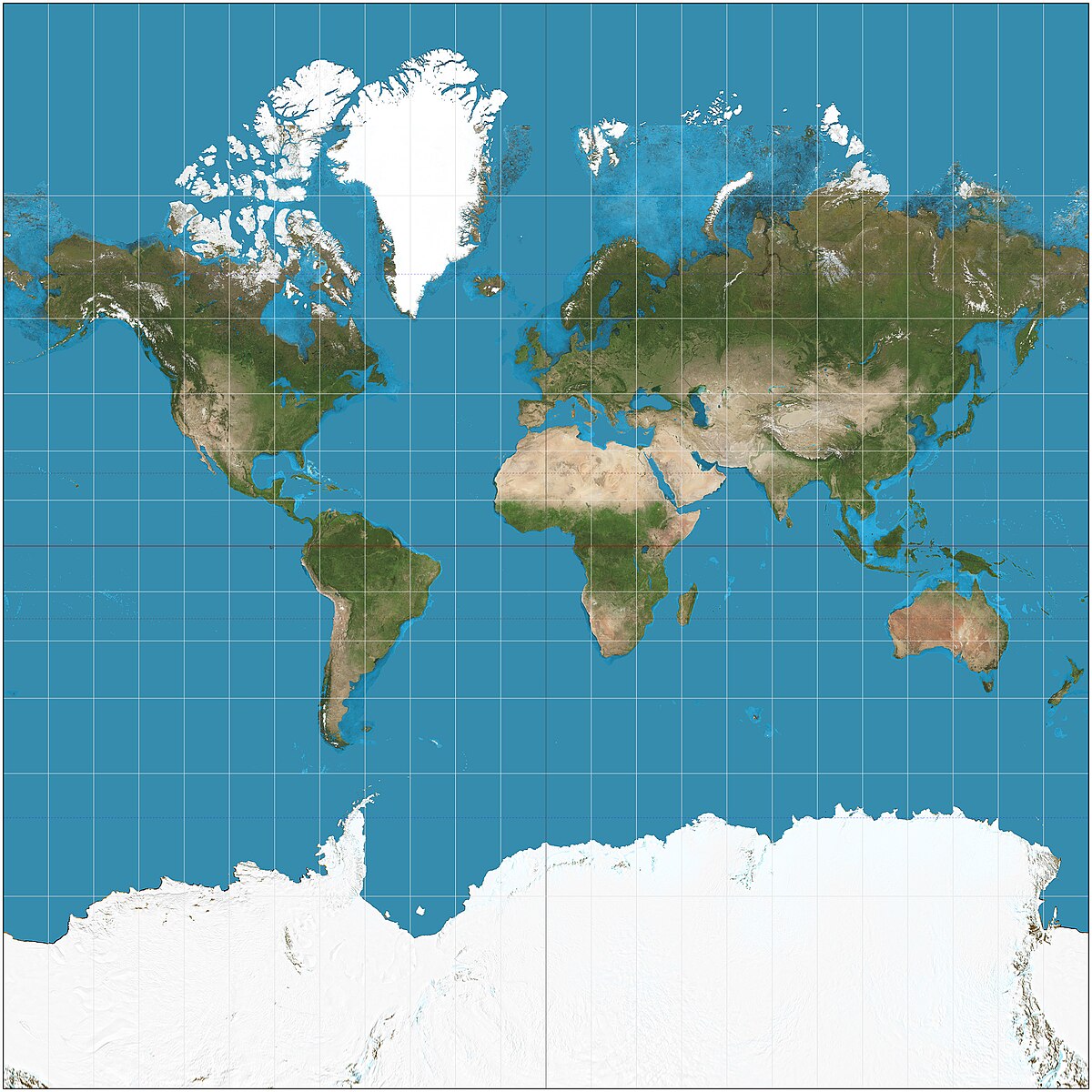
The Mercator Projection shows latitude and longitude lines at…
right angles.
The Mercator Projection preserves…
shape.
The Mercator Projection distorts…
land sizes.
The Mercator Projection is usually used for…
navigation.
This is the…
mercator projection.
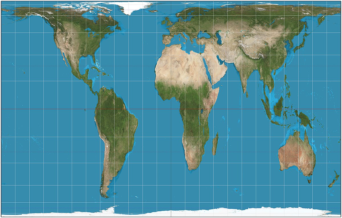
The Gall-Peters Projection preserves…
size of land.
The Gall-Peters Projection distorts…
shapes.
This is the…
gall-peters projection.
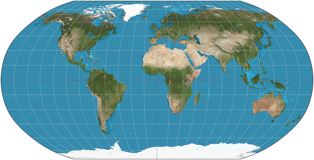
The Robinson Projection preserves…
size and shape.
The Robinson Projection distorts…
polar areas.
The Robinson Projection is often used in…
published atlases.
This is the…
robinson projection.
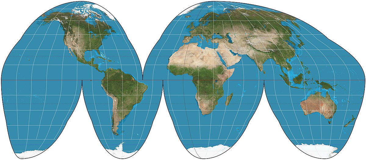
The Goodes Projection removes much of the…
oceans.
The Goodes Projection preserves…
size and shape of land masses.
The Goodes Projection is often used for…
thematic maps.
This is the…
goodes projection.