Systematic Geography
The study of a particular element(phenonemon)(earths integrated systems) as a whole, instead of focusing on particular phenomena in a single place.
Human Geography
a branch of systematic geography which studies spatial relationships between human communities, cultures, economies, and their interactions with the environment
Region
A categorization of land created by people, that has boundaries, unifying characteristics that set it apart, and covers space. these boundaries however can sometimes overlap, creating disagreements.
Vernacular/ perceptual region
(REGION)An area that people believe exist as part of their cultural identity. Informal sense of a place
Ex for vernacular/perceptual region
(REGION)(EX)(SYN)people thinking of sweet tea when they think of “the South”.
Functional/Nodal Region
(REGION)(SYN) social or economic function that occurs between a node or focal point and the surrounding areas.
Ex for functional/nodal region
(SYN)(REGION)(EX)delivery routes from a pizza shop. The shop would be the focal point and houses within delivery distance make up its _________.
Other examples: (metropolitan areas, megaregions, school districts, and the range of broadcasting technology. )
Formal/Administrative/Uniform/Homogeneous Region
(REGION)(SYN) A type of region where everyone shares a common attribute or trait like language, climate or political system. Could be a politically divided boundary(Brazil) physical(Shara dessert), cultural(southwestern Nigeria where everyone speaks Yoruba), or economic(Gold coast of Africa(ghana), that exports gold.)
Ex for Formal/Administrative/Uniform/Homogeneous Region
(REGION)(EX)(SYN)the French-speaking region of Canada, the dairying region of North America, a country.
Stimulus Diffusion (similar to glocalization)
(DIFFUSION) When an idea diffuses from its cultural hearth outward, but the original idea is changed by the new adopters.
Ex for stimulus diffusion (similar to glocalization)
(DIFFUSION)(EX)another part of the world’s fast-food chain from own culture might find different menu items than in the country that the traveler is from.
Contagious Diffusion
(DIFFUSION)distance-controlled spreading of an idea through a local population by contact from person to person.
Ex Contagious Diffusion
(DIFFUSION)(EX)Spread of COVID-19
Expansion Diffusion
(DIFFUSION)when innovations spread to new places while staying strong in their original locations.
Ex of Expansion Diffusion
(DIFFUSION)(EX)Islam has spread throughout the world, yet stayed strong in the Middle East, where it was founded.
Ex of Hierarchical Diffusion
(DIFFUSION)(EX)Fashion trends spreading from Paris to smaller cities
Hierarchal Diffusion
(DIFFUSION)when an idea spreads by passing first among the most connected individuals(usually in a higher class), then spreading to other individuals)(usually in a lower class
Reverse hierarchical diffusion
A trait diffuses from a lower status to a group of higher status. Walmart diffused from rural Arkansas to small cities and is now in nearly every city in the US.
Relocation Diffusion
(DIFFUSION)When people move, or relocate, they spread ideas along with them.
Ex Relocation Diffusion
(DIFFUSION)(EX)the spread of Christianity by missionaries who travel from their homes directly to faraway places to seek converts.
Cultural Integration
Interconnectedness of all of a culture: no part can be altered without creating an impac on another component of the culture
Cartography
Art and Science of maps and mapping
Reference Maps
(MAPS)A general-purpose map that attempts to show geographic features such as roads and landforms accurately and in detail (Show without interpretation)
Plat Maps
shows and labels property lines and details of land ownership
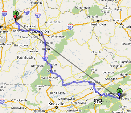
Road Maps
(MAPS) A reference map showing the roads of a city, state, or other area
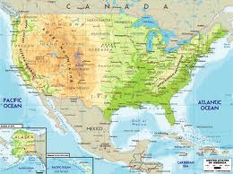
Physical Maps
(MAPS)Reference Map that shows landforms like deserts, mountains, and plains.
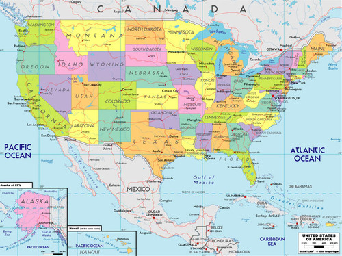
Political Maps
(MAPS) Maps that are designed to show the governmental boundaries of countries and states
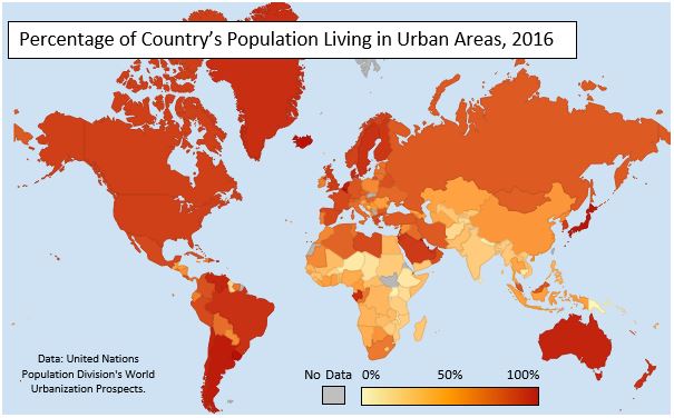
Thematic Maps
(MAPS)A specific-purpose map that shows the distribution of one or a few themes or variables (ex: unemployment rates by country)
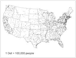
Dot maps
(MAPS)A thematic map that shows the occurrence of one or more instances of a feature with a dot as a specific location.
Choropleth Maps
(MAPS)a thematic map that uses differences in coloring, or the placing of symbols within predefined areas to indicate the average values of a property or quantity in those areas.
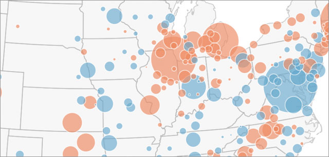
Graduated Symbol map
(MAPS)a thematic map that uses symbols with varying sizes to indicate the average values of a property or quantity in those areas.
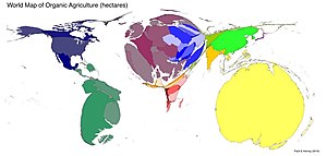
Cartogram
(MAPS)Thematic map that rescales the size of an area to be proportional to the feature it represents. (shrinks/expands sizes of regions to correspond with variables value)
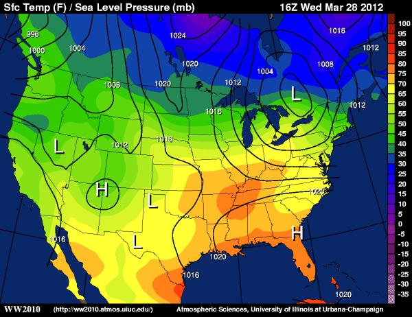
Isoline/Isometric Map
(MAPS)(SYN)Map line connecting points of equal value on some variable. Close-together lines show rapid change, where the lines are farther apart, the phenomena is relatively the same.(Topographic(elevation), weather, temperature, and precipitation maps)
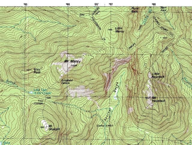
Topographic Map (pg 11)
(MAPS)Type of isoline map used to show the three-dimensional ups and downs of the terrain, designed to show the elevations and landforms of the Earth's surface using contour lines
Cognitive/Mental Map
(MAPS)(SYN)A map based on the set of mental representations people hold in their mind that expresses their beliefs/knowledge about the layout of the environment at different scales.
Density
Quantity of some feature(people, buildings, animals, traffic) per unit area/size
Population Density
(DENSITY)a measure of the # of people per unit area of land, within predetermined limits.
Arithmetic/crude Density
(DENSITY)(SYN)The total number of people divided by the total land area.
Ex of Arithmetic Density
(DENSITY)(EX)The number of People per square kilometer in Japan
Physiological Density
(DENSITY)the number of persons(the entire population) per unit of arable land. Measures the entire population of the location per the arable land there. Arable land is where food can get grown so it shows how much food a location needs to get out in order to feed its population.(High number= a lot of resources are needed from one plot of land, meaning that location will prob have to import/increase their crop yields.)
Ex Physiological Density
(DENSITY)(EX)population of egypt divided by its arable land
Agricultural density
(DENSITY)measures number of farms farmers per unit of arable land. Shows how efficient the society is in producing food. Lower agricultural densities=country is usually more developed as it has access to more technologies and does not need as many farmers to produce for its population.
Densely populated region
Northern Europe
Space
is the geometric surface of the Earth. The are between two or more phenomena or things.
Activity Space
the area wherein activity occurs on a daily basis
Complementarity
Actual or potential relationship of 2 places or regions that each produce different goods or services for which the other has an effective demand, reuslting in an exchange between the locales.
Ex Complementarity
(EX)a place with surplus crop production would be in a sense _________ to a place that has demand for food products.
Transferability
the potential for exchange between places based on an analysis of the cost in distance and time vs. the benefits of movement.
3 factors: Distance, time, and money. (“Dame Tres Monedas”)
Intervening Opportunity (Concept by Everett Lee)
The concept that closer opportunities will reduce the attractiveness of interaction with more distance- even slightly better- alternatives; a closer alternative source of supply between a demand point and original source of supply.
Periphery
less developed countries or regions that are economically and politically weaker than core countries. (outside the boundary of something)
Situation
The location of a place relative to other places. (relative location)
Ex Situation
(EX)San Francisco's situation being a port of entry on the Pacific coast, adjacent to California's productive agricultural lands.
Site
The physical character of place; what is found at the location and why it is significant(Climate, topography, soil, water sources, vegetation, and elevation.)(absolute location)
Ex Site
(EX)the ____ of Athens was built on hilltops because they were a natural barrier for the defense of the city.
Place
A specific point on earth with human and physical characteristics that distinguish it from other places.
Ex Place
(EX)The City of Medellin is a _____ that has big mountains that surround the city.
Relative Location
(R or A) defines a place in relation to another location. usually defined through connectivity and accessibility.
Connectivity
How well two locations are tied together by roads and links
Accessibility
How quickly and easily people in one location can interact with people in another location.
Ex Relative Location
(R or A)(EX)Describing a city as east of the rocky mountains
Absolute Location
(R or A)Position on Earth's surface using the coordinate system of longitude (that runs from North to South Pole) and latitude (that runs parallel to the equator).
Ex Absolute Location
(R or A)(EX)A street address is a fixed point that describes the location of a place
Relative Distance
(R or A)Measures distance in ways such as monetary costs or time. May vary with improvements in transportation/communication/technology.
Ex Relative Distance
(R or A)(EX)New York is 2 hours away
Absolute Distance
(R or A)physcial separation between 2 points in space, measured on standard unit of length, such as miles or kilometers, without considering any subjective factors like emotions.
Ex Absolute Distance
(R or A)(EX)5 kilometers away
Relative Direction
(R or A)Direction with respect to an objects current location and orientation rather than objective systems such as cardinal directions or landmarks.
Ex Relative Direction
(R or A)(EX)Directions such as left/right, forward/backward, and up/down are _____ to an object's current orientation.
Absolute Direction
(R or A)direction with respect to global location refereces (cardinal directions)
Ex Absolute Direction
(R or A)(EX)The hospital in northeast
CBD-Central Business District
core of the urban landscape known as
Distance Decay (Ravenstein)
The declining intensity of any spatial interaction with increasing distance from its point of origin
Friction of Distance
measure of the retarding/restricting effect of distance on spatial interaction. Greater the distance=greater the ____ and the less interaction. Distance usually requires some amount of effort, money, and/or energy to overcome.
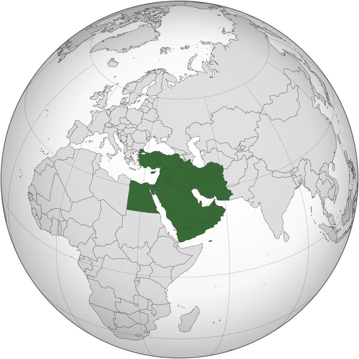
Middle East
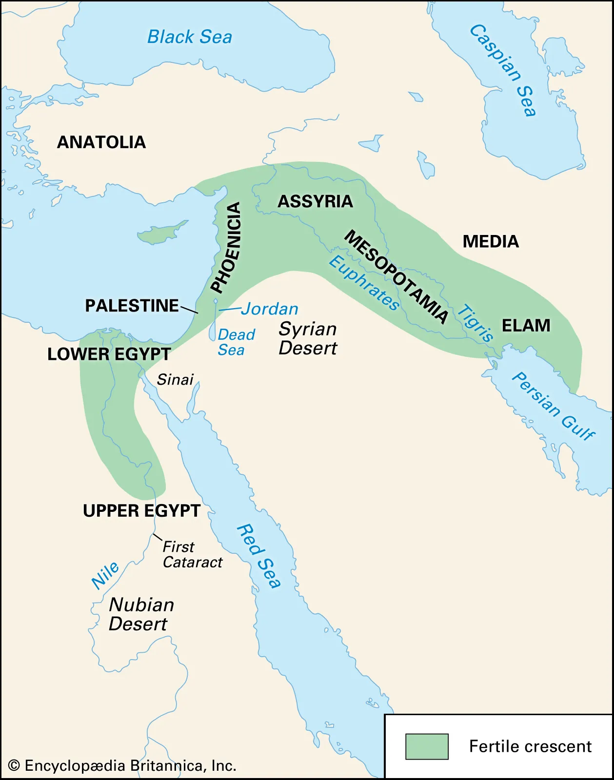
Fertile crescent
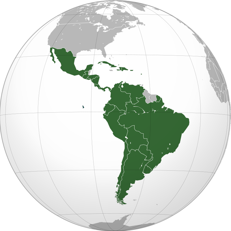
Latin America
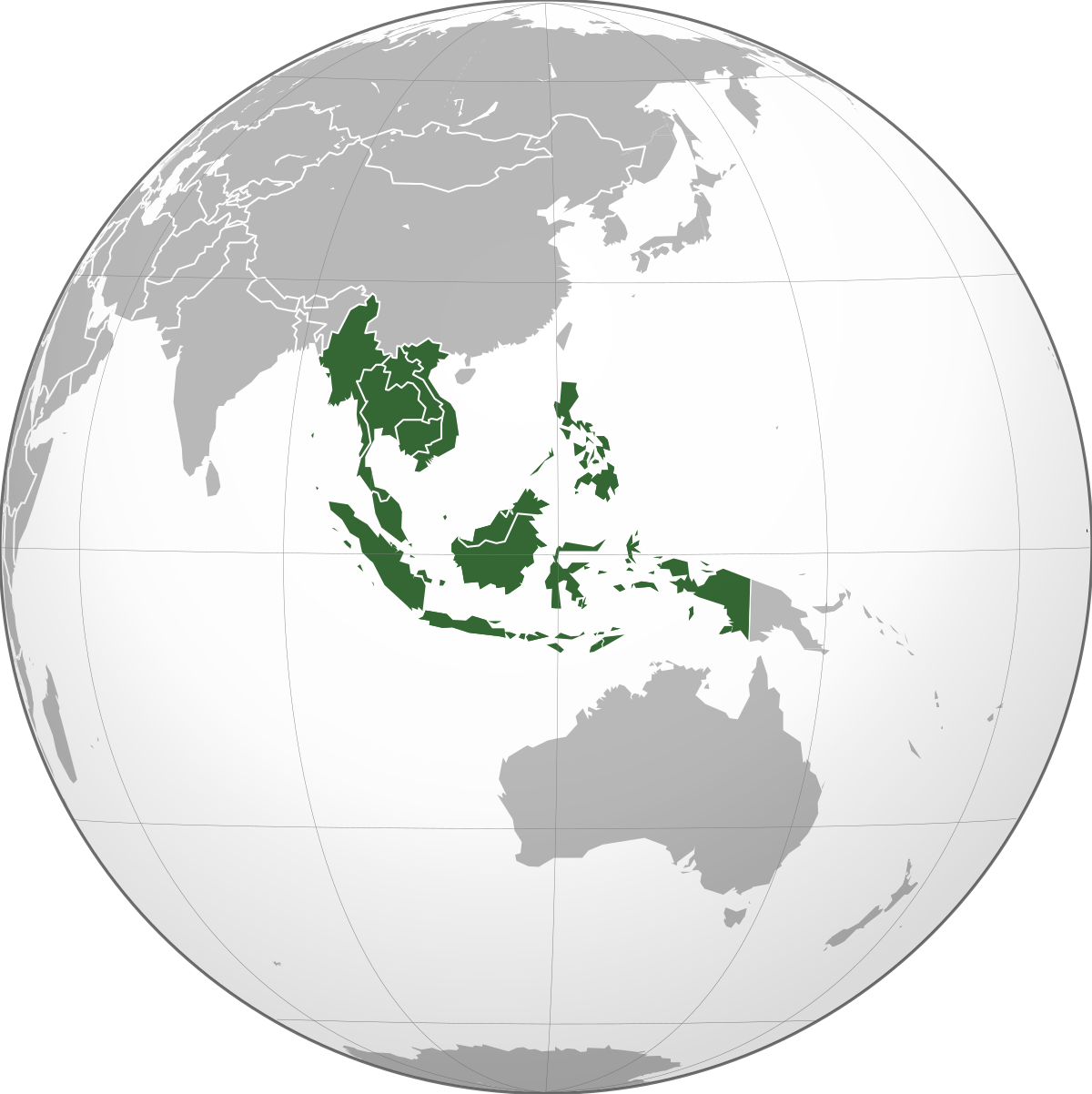
Southeast Asia
South Asia
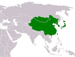
East Asia
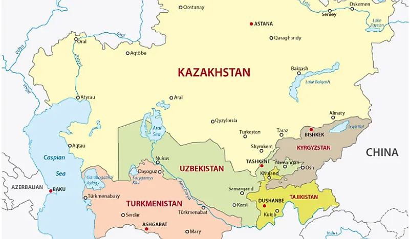
Central Asia
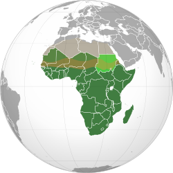
Sub-Saharn Africa
Global Grid System
the set of imaginary lines of latitude that intersect at the right angles to form a coordinate reference system for locating points on the surface of the earth.
Prime Meridian
0 degrees longitude
International date line
180 degrees longitude
Equator
0 degrees latitude
Latitude(Parallels)
The distance north or south of the equator. Circles the globe exactly halfway between the North and South Poles.(0 degrees to the Equator and 90 degrees north and 90 degrees south)
Longitude(Meridians)
distance east or west of the prime meridian that runs from pole to pole through Greenwhich, England. (0 degrees
Map Projection
method chosen to represent and draw earths curved,globe surface as a flat 2D map.
Interrupted map
(Projections) Wedges are removed to try to remove distortion
Uninterrupted map
(Projections)Maps have more distortion but have no wedges or “break points” in the map
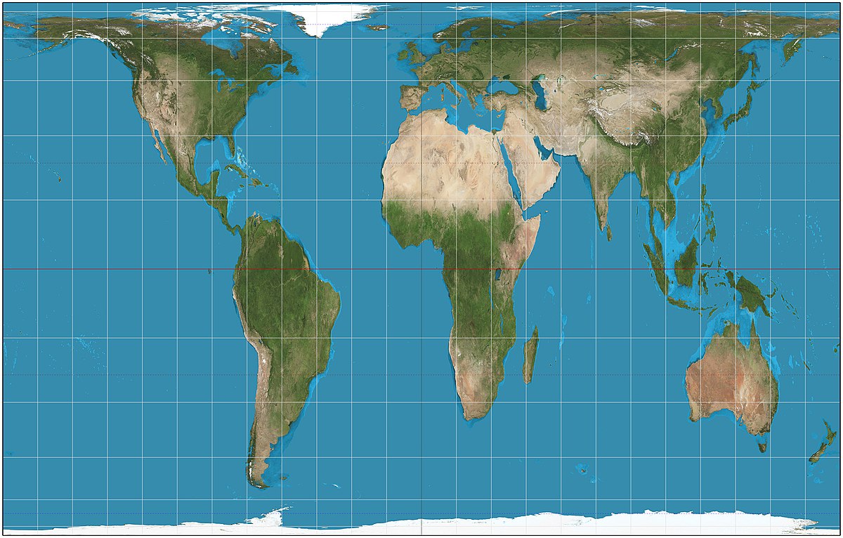
Mercator Projection/Conformal Projection/ Cylindrical Projection
(Projections)(SYN)Type of uninterrupted map that was used as a marine navigation tool. Longitude and Latitude create 90-degree angles. Direction lines are straight and constant. Suffers from distortion with sizes and shapes to preserve and reduce distortion with the direction. Inaccurate in the poles.
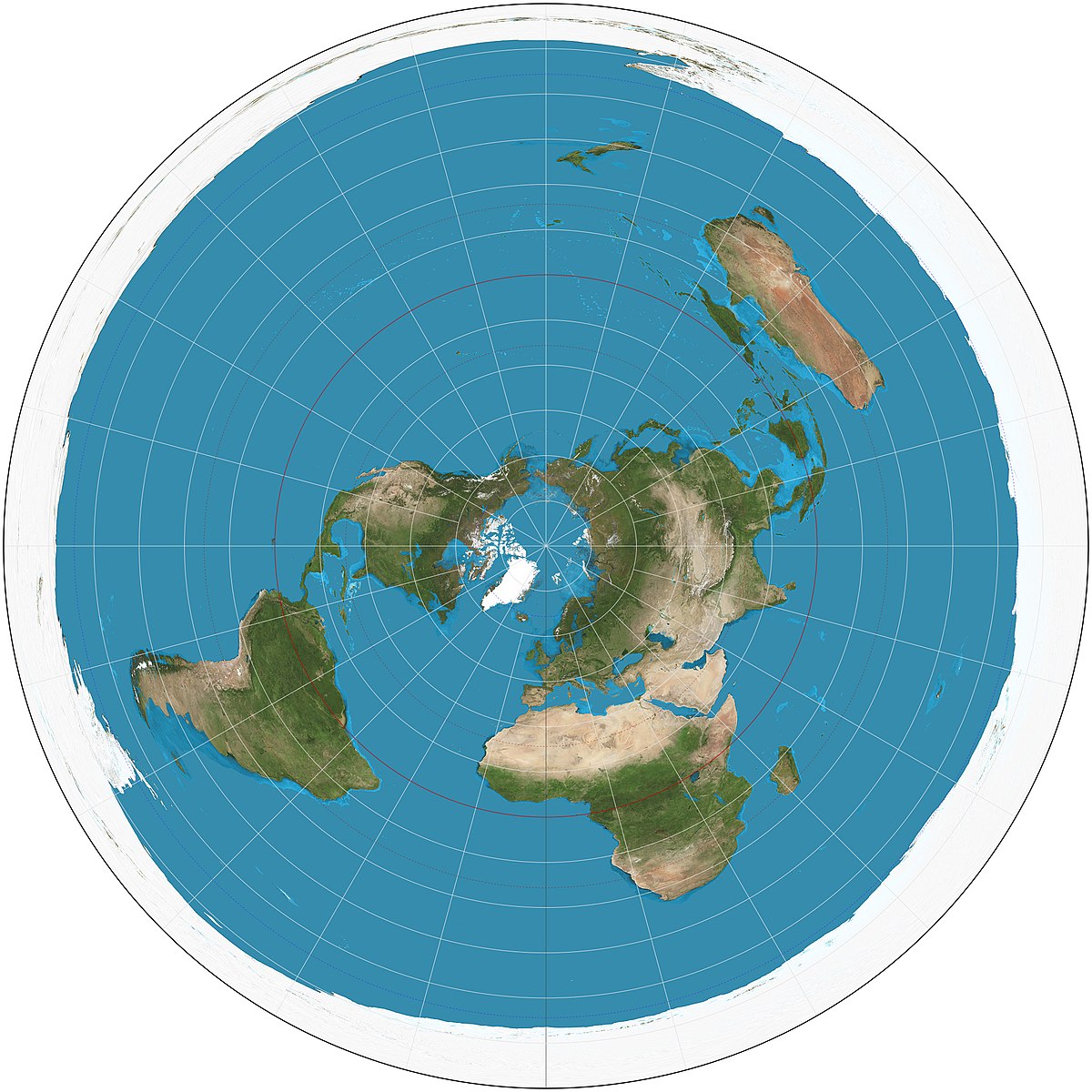
Azimuthal/Planar Projection
(Projections)(SYN)depicts the Earth as centered around either the North or South Pole.
Winkel Tripel Projection
(Projections)Type of uninterrupted map that is almost a rectangle but shaves off corners. Minimal distortion in size, distance, and direction but suffers from distortion in poles and curved latitude and longitude lines.
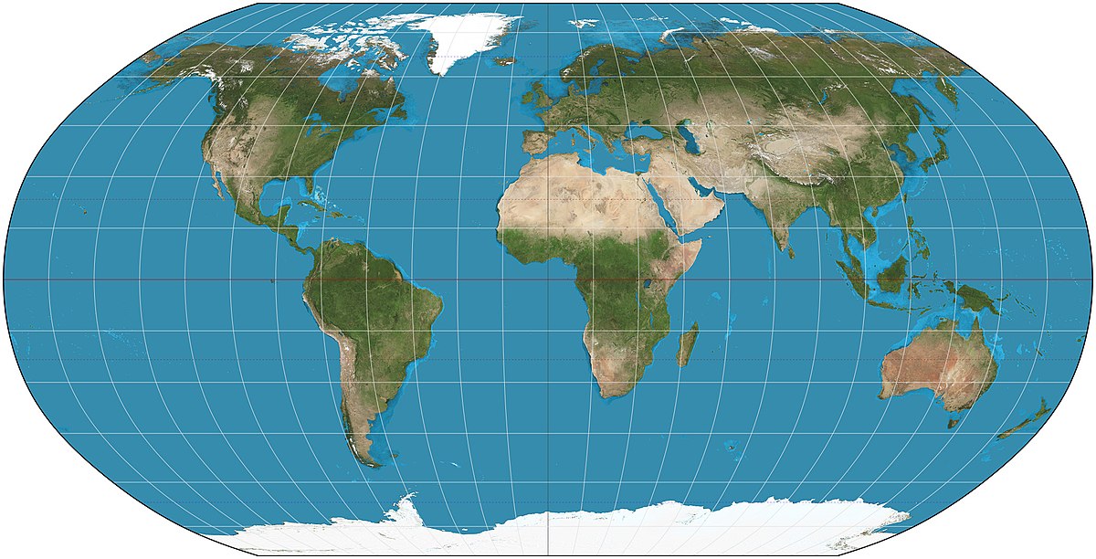
Robinson Projection
(Projections)Type of uninterrupted map that is almost a rectangle but shaves off corners. reduces distortion by disorting everything in the map a little bit (size, shape, distance and direction). Visually however(through the naked eye) it looks like it has less distortion.
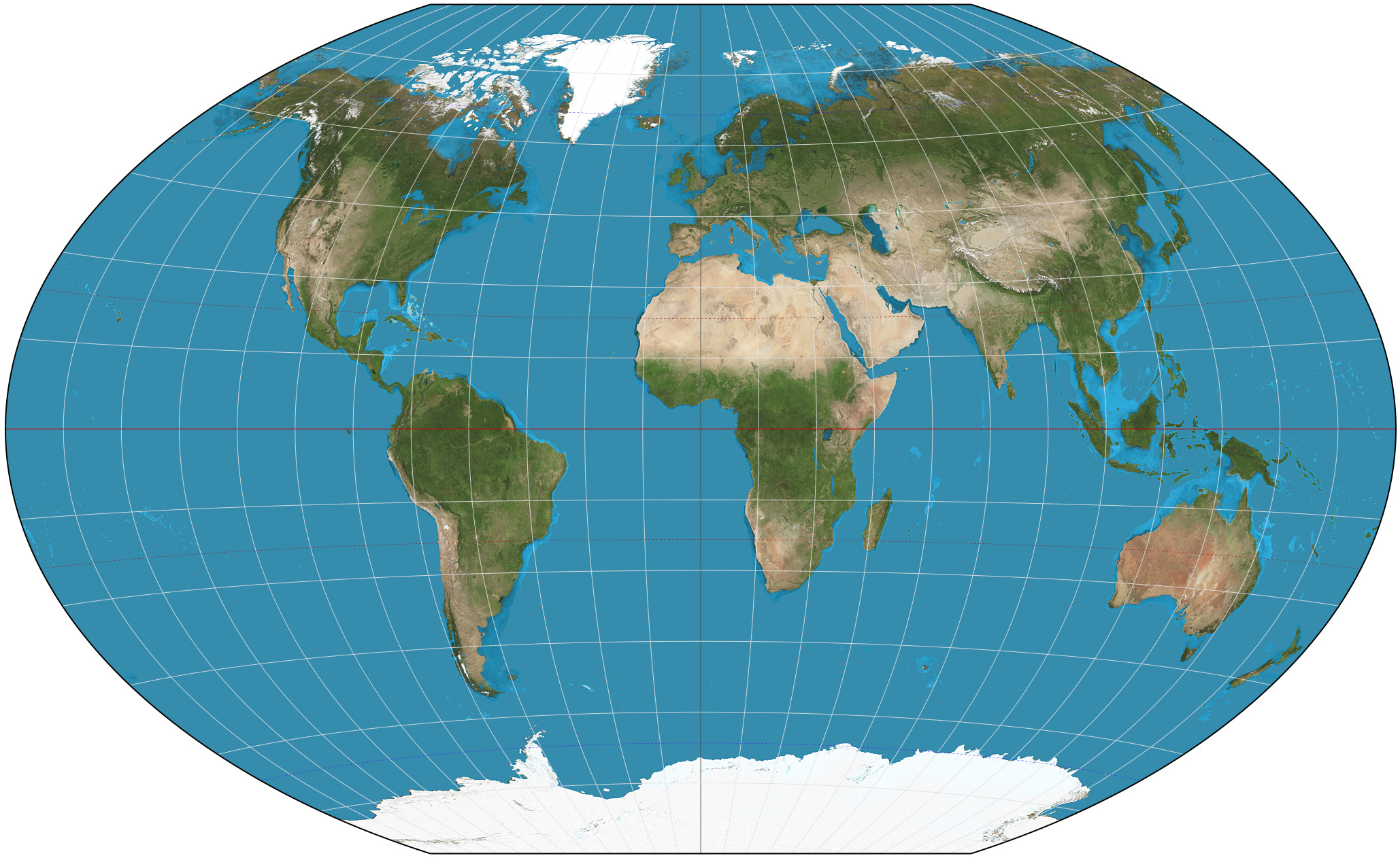
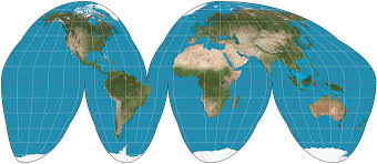
Goode’s Homolosine Projection/Equal-area Projection
(Projections)(SYN)Type of interrupted map that reduces most of the distortion on sizes of areas but suffers with presenting information and struggles with direction. Will not have an accurate depiction of the ocean. (Composite map: multiple images overlayed on top of each other merged together to create one map)
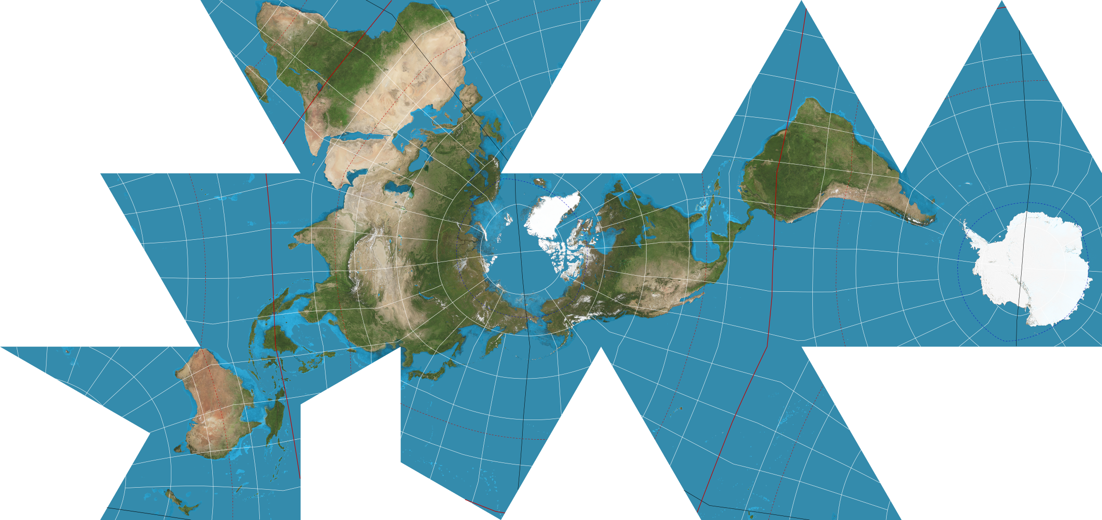
Fuller Projection
(Projections)Type of interrupted map that reduces most of the distortion on sizes of areas but suffers with presenting information and cardinal directions. (compromised projection: attempt to minimize distortion by spreading it all around)
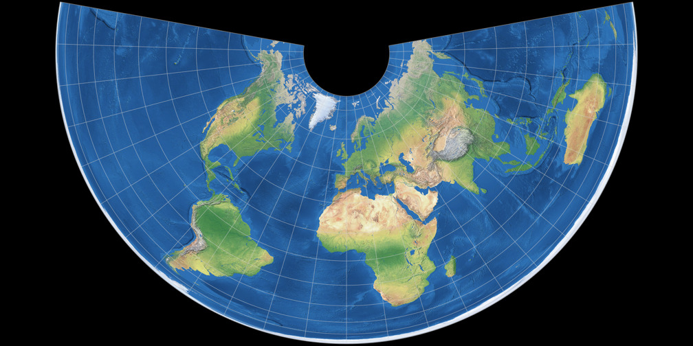
Conic Projection
(Projections) A type of interrupted map where lines of longitude converge, lines of latitude are curved, and it shows size and shape close to reality. Struggles with direction and on a world map, longitude lines converge at only one pole. Used mainly at midlatitude countries.
Peters Projection
(Projections) Type of uninterrupted map that’s similar to the mercator but shows the relative sizes of land masses more accurately, but distorts shapes(especially near poles). Main purpose is ti show spatial distributions related to area
Sequent Occupancy
The notion that successive societies leave their cultural imprints on a place, each contributing to the growing cultural landscape. The way cultures have modified areas over time-historically. (Harlem contains Jew synagogues, public spaces named after african American leaders, street names honoring puerto rican leaders.)