


Earthquake Mitigation
Mitigation Efforts
Hazard zone mapping: identifying danger areas
Begins with identifying nearby faults
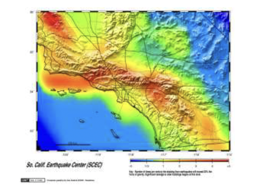
Once the fault zone is identified, geologic evidence and recorded earthquake history can help establish intensity zones around the fault.
These intensity zones provide a basis for estimating future risk.
Risk can be mitigated with a focus on these zones through efforts like public education and earthquake resistant structures.
Some structures can be built with extra reinforcement to withstand intense shaking.
More commonly, structures are designed with some kind of inherent flexibility or some kind of shock absorption system to absorb the shaking without breaking apart.
Warning systems
Dependent on earthquake prediction, which centers on:
Seismic activity along fault lines – trying to identify foreshocks or unusual patterns of seismic activity
Pressure increases
Pressure may cause the rocks to swell (often called dilatancy) and sometimes that might cause tilting or uplift of the ground surface near the fault.
The pressure increase in the rocks might also cause gases to be squeezed out into local water wells, might cause changes in the electrical conductivity of the rocks, or may increase the velocity of seismic waves traveling through the rocks.
Long-term predictions
Probabilistic; eg. a prediction of an 80% probability of an earthquake along a particular fault line in the next 20 years
Require a longer history of earthquakes along the fault based on geologic evidence
Eg. displaced landforms, rock layers, and sediment layers
This study is called paleoseismology, another goal of which is to identify seismic gaps
Seismic gap: a section of a fault that has not had an earthquake in a long time
Such gaps are often deemed “overdue” for earthquakes
Part of the fault where pressure has perhaps built to a dangerous level, a section of the fault that could shift at any time